Schadow1 Expeditions - the website (but not the mapping advocacy) will be turning a decade old on November 26.
This is after over 35 mapping expeditions in the country, calculating more accurate heights of mountains we have mapped, placing over several hundred thousand kilometers of roads and trails, mapping over 2 million structures, and introducing several previously unknown tourist attractions in the country.
We reminisce how we have turned our hobby and passion of mapping roads and sharing these mapping data and information into words and experiences as well as videos.
Initially, to bring experiences and faces to the men and women who have been building our maps in the Philippines.
We then brought these mapping data to bring it to a higher level of advocacy. Bringing not only ease of navigation through our #NeverGetLostInPH but also livelihood to some or many who have directly or indirectly benefited due to the tourism boom in their once-unknown paradise as we bring exposure to their locations through the maps we create. Through mountain trails, bike trails, off-road, and many more. These data are now published not only in our own Schadow1 Expeditions GPS Routable Maps of the Philippines but also on many other maps in the country.
 |
| GPS Routable Map of the Philippines (3D, Humanitarian versions) |
 |
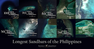
| Mapping and identifying the Longest Sandbars in the Philippines |
We also turned from navigation to disaster response with our #mapPHL which provided first-responder navigation data from the record-breaking storm that fell when our website was only less than a year old and helped map the exposure of communities to hazards by mapping over 1.7 million structures in the country.
Intersecting these data with hazard maps developed by some of our friends in the academe provided a better understanding of how we can improve disaster resiliency.
We have been actively mapping and sharing our navigation data from Severe Typhoons, to armed conflict, pandemics, emergencies, and to potential earthquake events and sharing this data to responders and disaster risk reduction managers and the United Nations.
Although we also experienced harassment from some companies who were affected negatively by the data we provided This cost us legal battles as they utilized the Cyber-Libel law to silence this information that was supposed to help people prepare and be aware. Justice won in the end.
While we were traveling, we saw islands without electricity. From this, we came to the realization of the need of improving the country's #RenewableEnergyPH and devised a constant that can be used to calculate the Optimal Tilt of Solar Panels in the Philippines.
 |
| Calculating the Optimal Tilt of Solar Panels in the Philippines |
We upgraded our way of collecting geospatial data as we have grown older. We started the "Video Mapping" technique in the country, back in a time when we only have "primitive devices" to intersect video and coordinates together. Until recently we have used drones, not only to take photos but also to take 3D spatial data and provide 3D maps.
10 years seems to look so short yet we have done what we could with our passion to bring #ExpeditionAccurate maps so that a Filipino would not be a stranger to his own motherland.
We look forward to bringing more maps, data, and opportunities for our fellow countrymen.
THANK YOU to those who continue to support us and continue to believe in what we do.


No comments:
Post a Comment