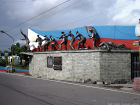
This coming June 12, 2013 is the 115th Anniversary of Philippine Independence and so we collated historical sites that paved way to the country's independence. Primarily, the successful separatist movement from Spanish colonial rule and the official proclamation started at the province of Cavite. This blog post aims to guide our readers on where to go this June 12 to relive the route to Independence of our motherland, the Philippines.
View Cavite Historical Sites in a larger map
Battle of Imus - August 31, 1896
First massive victorious battle in Cavite that weakened Spanish presence in the area after a gruelling loss of Katipuneros at San Juan Del Monte, Bulacan
Coordinates: 14.430023,120.9403
Bantayog ng Trece Martires (13 Martyrs) - September 11, 1896
13 captured members of the Katipunan were rounded up and executed at former Fort San Felipe in Cavite (now Trece Martires City)
Coordinates: 14.280926,120.870873
Battle of Zapote River - February 17, 1897
The battle that ended the supplies and logistics capability of Spain that separated and left Cavite under the powers of Filipinos.
Coordinates: 14.463795,120.966246
Tejeros Convention - March 22, 1897
Sad history in Philippine politics where elections were manipulated by the Cavite elites to remove Andres Bonifacio's influence in the uprising against Spanish rule. Emilio Aguinaldo became president of the Philippine revolutionary government.
Coordinates: 14.401071,120.860697
Andres Bonifacio Shrine - May 10, 1897
Following the fall of Andres Bonifacio, the men of Emilio Aguinaldo have executed Andres Bonifacio, the leader of Katipunan, at the foot of the Palay-Palay mountain range due to "treason".
Coordinates: 14.262636,120.717251
Battle of Alapan - May 28, 1898
The final battle that ended Spanish rule in the Philippines after Spanish military elites where overrun and killed in battle. This battle also marks the first time the modern Philippine flag was waved in victory.
Coordinates: 14.415668,120.918662
Declaration of the Republic of the Philippines - June 12, 1898
Emilio Aguinaldo declared Philippine Independence at his home at Kawit, Cavite.
Coordinates: 14.445086,120.906825
For more information on how to get to these sites via public transportation, you may check out our article below:
Roadtrip to Historical Sites in Cavite
Or you may also check out the Andres Bonifacio Shrine at Mt. Nagpatong from our article here.
The Neglected Andres Bonifacio Shrine
The waypoints to these historical sites have been mapped by Schadow1 Expeditions and are contributed in the following mapping consortia as part of our advocacy.
Openstreetmap Philippines
Roadguide Philippines
Google Maps
Openstreetmap Philippines and Roadguide Philippines provides a free downloadable routable map for your Garmin GPS Navigation system. For more information on how to use them, visit our #mapPHL page here.


No comments:
Post a Comment