Jomalig Island is a remote island of Quezon province. Too remote that it already borders with the Pacific Ocean; requires three hours land travel from Manila and an additional six hours boat ride from Real, Quezon while facing the challenge of strong waves coming from the ocean. As such, this island has become a point of concern of James Betia of Journeying James for his feeding project and Schadow1 Expeditions' Mapping Project. This article is an account of the 1st wave of getting in to the island to reach out.
It was 3 o'clock in the morning when all of us waited at the intersection of Legarda street and Nagtahan in Manila to ride a van for a 3-hour zigzag bumpy road to Real, Quezon where we will ride a boat to Jomalig island.
The island as of this time, is not a usual destination, as such, we would need to transfer boats in the middle of the ocean to get to this island.
Jomalig Island is a part of Quezon Province and is the farthest island of the Polilio Group of islands of Eastern Luzon. Being the most eastern island in northern Philippines, the island faces a challenge of frequently beaten by storms coming from the Pacific ocean as well as easterly winds. Waves are most of the time strong; and because of its topography, supplies from the mainland rarely goes in. The island itself is mostly flat and the soil is sandy therefore the island could hardly produce for its citizens. It is however abundant of fishes and untouched golden sand beaches.
 |
| Mapping up the trails and roads of Jomalig |
 |
| Untouched Golden Sands of Kanaway Beach, Jomalig Island |
In spite of this island being a potential tourist destination in the country, the children need help as last 2012, this island is where the most malnourished children are located in the Philippines.
Looking through Jomalig's situation, its locals need planning for its sustainable development, disaster planning, environmental protection, and tourism harnessing.
Upon hearing a call from one of our friends in Philippine Travel Blog, James Betia of Journeying James for a feeding project, Schadow1 Expeditions saw the opportunity to join his move and at the same time, to map the island for tourism, navigation, and humanitarian planning purposes.
The island as of March 2013 has zero open data and we have exploited this chance to make Jomalig Island be known to the Filipinos and the world.
At the morning of April 13, 2013, we headed on and gave out medicines, vitamins and food to some of the children at Barangay Talusoy where over 30 children have benefited from the donations.
 |
| James Betia of Journeying James is enjoying the time with the children. |
By noon until 7PM, Schadow1 Expeditions headed on to roam the entire island via a motorcycle to map it. A total of 133.5 kilometers of roads/routes and over 65 waypoints of residential area, barangays, sitios, and government institutions have been mapped. Below is the massive improvement of Jomalig Island's mapping data.
 |
| Pre-map up (Zero Data) |
 |
| After Schadow1 Expeditions Jomalig Island Mapping Project https://www.openstreetmap.org/?lat=14.701&lon=122.3662&zoom=13&layers=M |
Schadow1 Expeditions would like to thank the following for making this project possible:
- Journeying James
- Project Jomalig: Feed the Kids Project Wave 1
- Wabin Bernardo, my highly-skilled motorcycle driver that helped us out along the sandy, dusty trails of Jomalig
- Mayor Rodelo Tena and Mrs. Gloria Britania-Tena of Jomalig Island
- Jennifer Bernardo, Nutrition President of Jomalig
- Lydia Ayuso of DOH-Jomalig
- and other people who have helped us even in small ways to get to this island.
 |
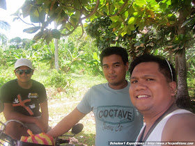
| Wabin (middle), my trusted motorcycle driver as I map the island. |
 |
| LGU units and 1st wave of volunteers of Project Jomalig: Elvie, Shammy, Marion, Lydia, Jennifer, Vanessa, Mayor and Mrs. Tena, Meg, Zarina, Myself, Arvin, Koko, James |
The massive mapping data obtained from Schadow1 Expeditions' Jomalig Island Mapping Project has been contributed to +OpenStreetMap Philippines and +Google Maps for free use of recreation enthusiasts, humanitarian groups and navigators who would like to check out this untouched island of Jomalig.
 |
| Trails and Waypoints obtained from the Jomalig Map-up |
Map
Openstreetmap Philippines Map (link)
Schadow1 Expeditions Contributions (link)
How to use for your Navigation System (link)
View Jomalig Island in a larger map
Related Articles on Jomalig Island
- Discovering Jomalig: The Golden Island of Eastern Luzon
- Jomalig Map-up and Kids Feeding Project 1st Wave is a Success
- Kanaway: The Sunrise Beach of Jomalig Island
- Salibungot: The Pink Sunset Beach of Jomalig Island
- Passages: Jomalig Island Quezon (external link, Harum-Scarum)
- Jomalig: The Kiss that Turned a Tourist into a Traveler (external link, BossAel is Out-of-Office)
- Project Jomalig Report and Updates (external link, Journeying James)


kudos bosing!
ReplyDeleteyou dont know how grateful i am with this project of yours.
sakto ka talga sa team. sa uulitin!
Thanks sir! Your Project Jomalig is a sure gem as well for the kids and the community. Our efforts hopefully should lead to the improvement of the lives of the Jomalig people, environment protection awareness, and to prepare them for the inevitable tourism boom of their island. See you again on future outreach and expeditions.
Delete