 |
| Mt. Vulcan |
Mt. Vulcan is a volcano that erupted furiously during the 19th century and has dramatically changed the land feature of western Camiguin Island. Before the eruption, the area was one of the thriving settlement during its Spanish colonization not until it was completely buried and is a part of the Bonbon town of Camiguin presently. Schadow1 Expeditions went out for about an hour trek to map the path of this 580 MASL inactive volcano.
Mt. Vulcan is an inactive volcano situated between the boundary of Mambajao and Catarman town at Camiguin's west side. Presently, a walkway was built and is called the Panaad Walkway with Stations of the Cross. Catholics of the town trek through this walkway during the Lenten Season.
 |
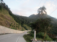
| Start of the Panaad walkway |
 |
| The start of the trail to Vulcan summit and is found between 11th and 12th station |
 |
| Mt. Vulcan's summit as seen from the walkway |
Almost half of the walkway have steps and will become unpaved and rocky as you pass the 8th station. It will have steps again on the 13th up to the 15th station.
 |
| Panaad Walkway |
Mt. Vulcan is advisable to be trekked during early morning as it becomes very hot starting noon. There are no large trees after station 8 and the sun will be facing directly to the path. However, this can also be trekked during the late afternoon if you want to enjoy the sunset.
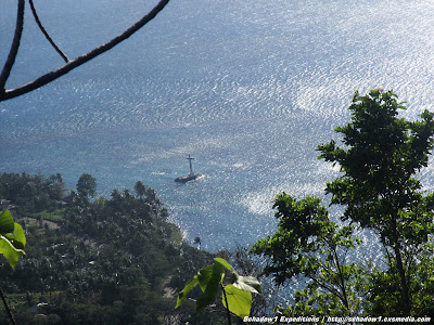
Nearing the last station of the cross, you would be able to see the Sunken Cemetery from below and is indeed a captivating scene of the western Camiguin Island.
 |
| Sunken Cemetery as seen from the endpoint of the path (15th station) |
 |
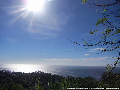
| The captivating view of Camiguin's western shore from Mt. Vulcan |
How to get there:
From Benoni Port, rent a Multicab for P450 to drop you off to the Station of the Cross, Old Vulcan
We went to Mt. Vulcan as part of our roadtrip in Camiguin Island and has rented a motorcycle without driver for P500/day.
 |
| Panaad walkway as plotted on Google Earth |
 |
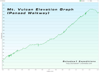
| Elevation graph of Panaad Walkway of Mt. Vulcan |
Contact:
Sauro for tour inquiries +63 927 4055966
The data gathered in this Mt. Vulcan (Panaad Walkway) trek has been contributed to the +OpenStreetMap Philippines project for free use of travelers who plan to check this volcano with GPS assistance.
Map
Openstreetmap Philippines Map (link)
Schadow1 Expeditions Contributions (link)
How to use for your Navigation System (link)
For a more detailed account of Schadow1 Expeditions on its 4- day Camiguin Adventure and Mapping Expedition, check on the links below:
- Camiguin Island Roadtrip - discovering the best of Camiguin for four days
- Conquering Hibok-Hibok Volcano 1337 MASL
- Mt. Vulcan Trail 580 MASL
- White Island - A majestic solitary sandbar at Camiguin
- Gui-ob Church Ruins - a reminder of Mt. Vulcan's Eruptive Past
- Sunken Cemetery, a cemetery turned coral reef
- Katibawasan Falls, grandeur with the waterfall flowing from Mt. Campana
- Ostrich Farm, Camiguin - the only ostrich facility in the Philippines
- Sto. Niño Cold Springs, Camiguin
- Ardent Hot Springs - relaxing dip after an H2 Traverse
- Paguia Cottages, a budget resort with big hotel-type rooms


No comments:
Post a Comment